System background
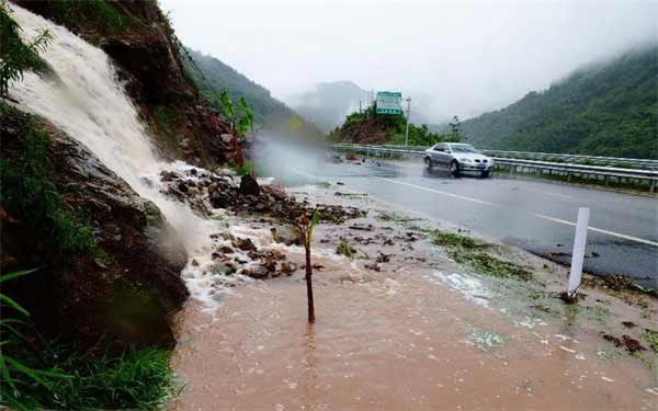
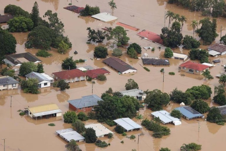
China is a mountainous country, with hilly areas accounting for about two-thirds of the country’s land area. China is mainly located in the East Asian monsoon region with a wide range of rainstorms. The monsoon climate determines the uneven distribution of rainfall throughout the year, and the flood season is highly concentrated. Flash floods caused by heavy rainfall occur most frequently and cause great harm. The hydrological automation monitoring system integrates data collection, transmission, analysis, and alarm. It realizes timely and accurate uploading and distribution of early warning information, so that potential affected areas can take timely measures to minimize personnel and property losses.

System Overview
The hydrological automation monitoring system is used to obtain real-time water and rain information in a timely manner, and to timely produce and release flash flood disaster warnings, providing real-time weather forecast, rainfall and other meteorological information, as well as basic information and monitoring information of hidden danger points such as landslides and debris flows. The central early warning system transmits the dangerous information to the early warning system after the judgment. Finally, the early warning system releases the information through the wireless network. The LED display displays it in real time and the early warning broadcast terminal performs the early warning. After seeing or hearing the warning information, people will take precautions or evacuate in time.
Goals
The hydrological automation monitoring system realizes front-end data collection and back-end big data analysis and management. Through the Internet of Things technology, realize intelligent hydrological monitoring, improving the management efficiency and social service level of the water conservancy sector.
1. More comprehensive: Hydrological monitoring data collection is more comprehensive;
2. Faster: Hydrological disaster warnings are more timely and faster;
3. More accurate: real-time data transmission, comprehensive data analysis, and more accurate grasp of target data;
4. Smarter: Smart monitoring systems provide more professional event prediction and resolution plans.
System Composition
Hydrological automation monitoring system is divided into three parts: front-end data collection, wireless data transmission, back-end monitoring and analysis system
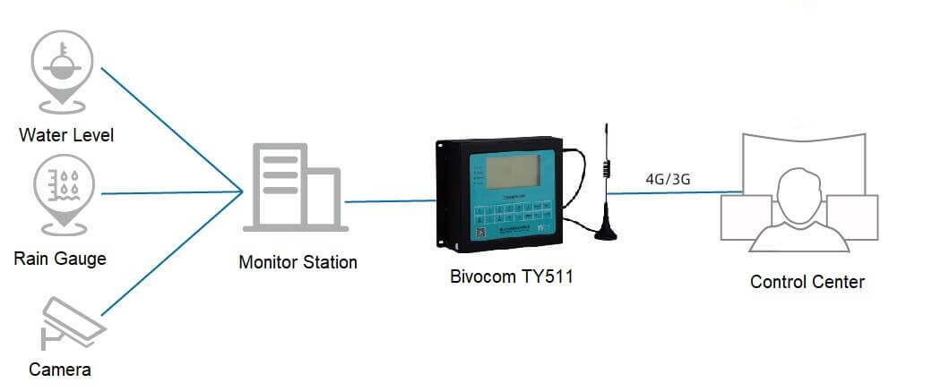
1. Front-end data collection: front-end water level gauges, rain gauges, cameras, and other sensor acquisition equipment collect field fact data.
2. Wireless data transmission: The data is transmitted from the front-end collection device to the TY511 RTU. The RTU then transmits the data to the designated center using 4G / 3G signals through wireless data transmission communication.
3. Multi-data center monitoring: RTU supports simultaneous transmission of multiple data centers, which facilitates real-time monitoring for background staff and real-time update and synchronization of data from multiple data servers and application servers.
System Topology Diagram

System Functions
1. Data query and monitoring
Real-time query of water level, rainfall, equipment battery voltage, etc., and monitoring of reservoir distribution locations and field equipment operating status.
2. Strong compatibility
Compatible with various types of water level, rainfall, displacement and other measuring instruments or sensors.
3. Stable performance
A variety of measures such as lightning protection, rain protection, moisture resistance, and input signal isolation are adopted to ensure that the equipment is safe and reliable.
4. Easy maintenance
Can set working parameters and upgrade program remotely.
5. Flexible access
Can be connected to Bivocom water and rain or mountain flood disaster monitoring and early warning system software platform, as well as configuration software or software systems developed by users.
① software platform:
The hydrological automation monitoring system mainly includes the following six functional modules: a large hydrological monitoring screen, a hydrological monitoring system, a data analysis analysis management system, a video conference system, a wireless early warning broadcast system, and an inspection and management system. The hydrological monitoring system is responsible for collecting on-site rainfall, water levels of rivers and reservoirs, mountain displacement and even water levels and feeding them back to the data center platform. The central platform analyzes and processes these data to generate early warning information, then release the warning information through LED broadcasting system to remind local people to prevent evacuation in a timely manner. The main control center initiates a video conference, conducts remote video conferences with cities, counties and even towns, discusses various emergency and rescue measures and issues corresponding instructions.
Hydrological Monitoring Screen:
Statistics and display the data that users care about, such as login user information, weather conditions, equipment conditions, today’s ecological flow alarm conditions, and the number of unread announcements. The homepage display mainly includes modules such as today’s alarm, total equipment, equipment online rate, number of online equipment, number of unread announcements, equipment status, and equipment alarm trend.
Hydrological Monitoring System:
Through the hydrological monitoring system, including the central monitoring platform and front-end monitoring equipment, mainly displacement monitoring, rainfall monitoring, water level monitoring and flow monitoring. Accurate data monitoring system greatly increases the amount of hydrological information collected, improves the timeliness of collecting hydrological information, and provides accurate basic information for forecasting, as well as early warning of mountain torrents and disaster prevention and mitigation.
Data Research and Analysis Management System:
By sorting and analyzing the basic data in the system (including rainfall, water level, discharge, displacement and other data), various types of correlation analysis charts are generated to visualize the results of task completion. Statistical analysis results can be used as data sources for leadership inspections, command analysis, and government reports.
Video Conference System:
The main function of the video conference system is to convene water conservancy work conferences, learn important spiritual documents of water conservancy, conferences such as disaster analysis and work deployment when major disasters occur. The video conference system includes a multimedia large-screen display, a multimedia audio and video signal source, a sound reinforcement system, and an integrated control center.
Inspection and Management System:
Through the unified collection and management of information in daily work (including daily collection data, daily management data, hydrological information, water speed data, task completion, etc.), effective supervision of daily inspection and management work is achieved.
Wireless Early Warning Broadcast System:
The wireless early warning broadcasting system analyzes and compares various monitoring data with historical data, and makes early warning information based on the data analysis results, or obtains early warning information through the water and rain monitoring platform. Then send the early warning information to the site timely and accurately for broadcasting early warning. The early warning system issues early warning to the early warning terminal via data information or voice format.


Comment